Outside the Mediterranean, calculating tides is a fundamental part of coastal navigation. Crossing a shoal, entering a harbor, passing over a sill, or identifying a suitable anchorage are all situations where it is essential to anticipate the water depth. Boaters aware of the consequences of a calculation error are often so anxious that they actually increase the risk of making one. However, by following a rigorous method and practicing regularly, you will quickly realize that it is not as complicated as it seems. Follow the guide!
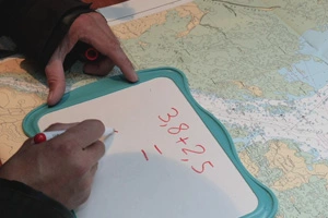

First, you need to find the correct information for the specific location where you want to calculate the water depth at a given time.
This information is available on the SHOM website, or in print versions like the coastal almanac or the Breton Sailor's Almanac for example.
Once you know where to find reliable information, Maël explains everything in a simple and step-by-step way.
It involves the rule of twelfths. He also covers "secondary ports," "under-keel clearance," and more.
What a pleasure it is to master the method and no longer panic when the numbers on the depth sounder start dropping inexorably!
To master it all, check out our full video in the level suited to your preferred platform
